

 |
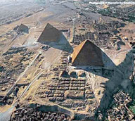
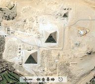
Color aerial orientation photo of the Giza Necropolis. Roll over portions of this image to see the three royal pyramid complexes and the names of the various cemetery surrounding them. Click "show all" to see all highlighted areas at once. |
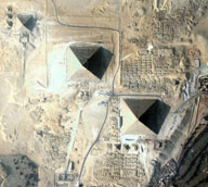 |
January 5, 2009 Color satellite photo of the Giza Necropolis (Quickbird). |
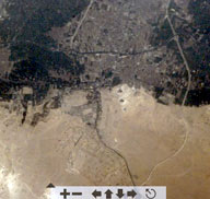 |
2001 Color satellite photo of the greater Giza region. |
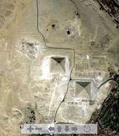 |
2000 Color satellite photo of the Giza Necropolis. |
 |
Color satellite photo of the Giza Necropolis (Space Imaging). |
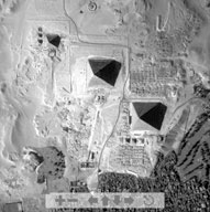 |
1999 Black-and-white satellite photo of the Giza Necropolis. |
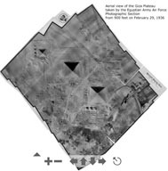 |
February 29, 1936 Aerial photo of the Giza Necropolis (Egyptian Army Air Force). |
 |
February 29, 1936 Aerial photo Khafre causeway, temples and Sphinx (Egyptian Army Air Force). |
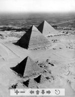 |
February 29, 1936 Oblique view of the Giza Pyramids (Egyptian Army Air Force). |
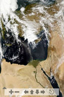 |
Color satellite photo of the Mediterranean Sea and Egypt, including Giza and the Delta. |
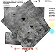 |
February 29, 1936 Aerial photo of the Giza Necropolis. Every tomb or pyramid is a button that flashes red when you roll over it. Click on a tomb and a new window will show all the photos and documents linked to that thomb. The blinking dots represent 1,400 currently available 360-degree QTVR ("Quicktime Virtual Reality") panoramas. Click on a dot and a new window will take you to that location. |
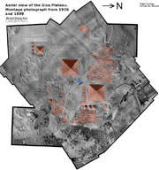 |
February 29, 1936 Aerial photo of the Giza Necropolis. Every tomb or pyramid appears on a red overlay layer. Click on a tomb and you can view photos, or open a new window containing all that tomb's information. There are also 1,400 currently available 360-degree QTVR ("Quicktime Virtual Reality") panoramas. To view one, drag and drop the blue "pin" anywhere on the photo, and the closest QTVR will appear. |